| Back to Travel Pages | Back to Route66 Home | Back to Home |
|
|
|
|
|
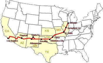
A selection of Route 66 photos taken along the road, on a recent trip to the Grand Canyon. A more complete, and exhaustive (if not exhausting) account of our circle tour, is located elsewhere on this site. This was my first journey on the old road, but will not be my last. In case you are interested, all photos on this page were taken with a Canon D30 digital SLR. Most were taken through the Canon 35-105 mm lens, though a 70-210, and a 24mm were also brought. A 1gb drive holds 721 shots. |
|
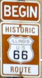 In the beginning(?)
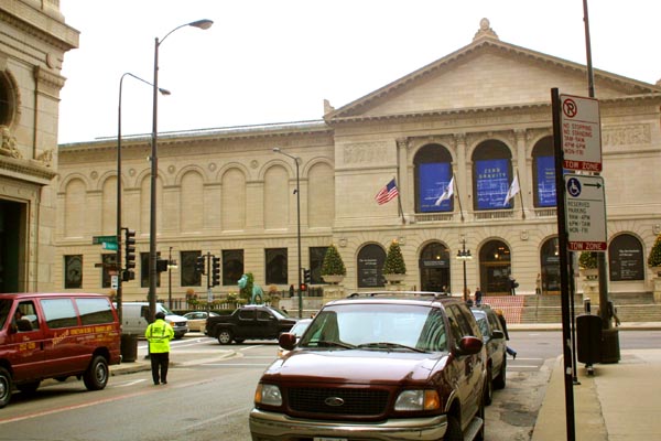
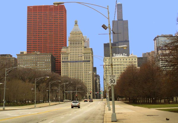
Almost 40 years after removing the original signs, at the closing of the old road, these new ones are being put up. They are being erected to guide the legions of travelers, from all over the world, who are seeking out the mother road. This sign is posted at Adams and Michigan. Purists, including myself, will argue that there is a better choice. Route 66 actually had two different starting points. The original was at Jackson and Michigan, a block south of here. This was moved to Jackson and Lake Shore Drive, in 1933. In 1955 Jackson became a one way street, west of Michigan, and traffic was routed along Michigan to feed into Adams. |
|
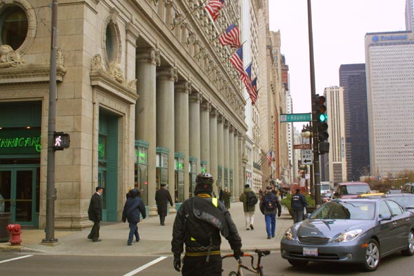
| Another look at the corner of Adams and Michigan,
this time looking north along Michigan. Though Route 66 traffic was routed
through Adams, this was never actually the start of the mother road. Since
it's change from Jackson and Michigan, to Jackson and Lake Shore Drive, in
1933, the beginning of the road was never altered. The official start of
the road remained at Jackson and Lakeshore Drive, until it's closure. |
|
| Jackson and lakeshore Drive. This is also, in
my opinion, the true starting point. This was the starting point of Route
66 from 1933 until the road was closed. This has also been the ending
point for east bound Route 66 from 1933, until the road was closed. Previous
to 1955, traffic heading west would go straight up Jackson, and head west
out of town. After 1955, traffic would start here, go up to Michigan, turn
right, go up to Adams, and take a left, to then proceed west out of town.
Though this might make it seem sensible to some, to relocate the beginning
of the road to Adams and Michigan, there is a reason that this was never
done while the road was in commission. Lakeshore Drive is the route
followed by US Highway 41, when it passes through Chicago. Two songs were
inspired by the roads that intersect here. They are, Get Your Kicks on Route
66, written in the fifties, and Lake Shore Drive, written in the seventies. |
|
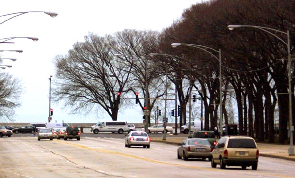
| A look south down Lakshore drive, a famous and
well regarded road in it's own right. Lake Shore drive is a part of US 41.
This old federal highway goes from Copper Harbor, in the upper peninsula
of Michigan, to Miami Florida, and has been traveled since 1926, about the
same time that Route 66 got it's start. The section of 41 which passes through
Chicago is called Lake Shore Drive, and is built on land fill. Before the
coming of the Interstate, Highway 41 was the main road from Milwaukee to
Chicago, and served as the main north/south highway for the area. Route 66
began here, and continued to have it's origin at this point, because it was
desirable to have these two great highways linked up. |
|
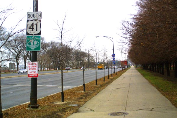
| A look up Jackson, towards Michigan and the original
start of Route 66. The area between Lake Shore Drive, and Michigan is all
landfill, and had previously been part of Lake Michigan. After the land was
reclaimed, Route 66 was moved down to the lake. |
|
| A monument is erected to America's favorite, and most fondly remembered road. It stands in Tucumcari, NM. This is a fitting place for such a memorial, as this is one of many cities which came to prosper because of the road. Tucumcari was particularly dependent, and thus particularly hard hit, when the road was bypassed. | 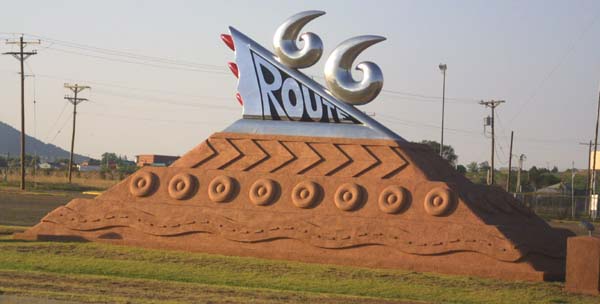
|
| An Illinois rest stop between Chicago, and Springfield, sports a somewhat more modest tribute to America's Main Street. | 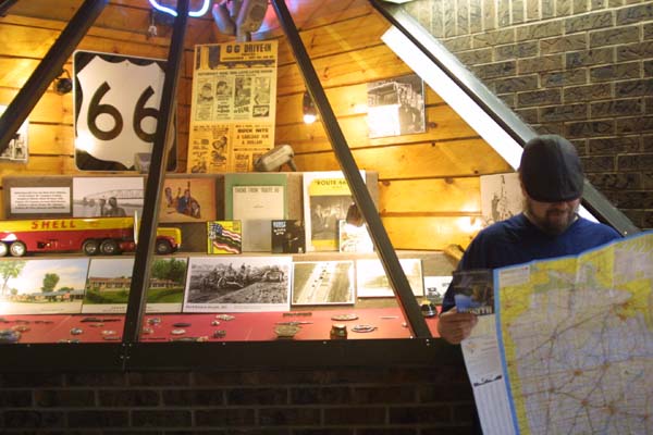
|
| One of many examples of a Route 66 Hall of Fame. This one is located at the Dixie Truck Stop, in Illinois. Numerous museums, halls of fame, and points of interest dot the old road. In the finest tradition of Route 66, most of these stops offer items for purchase. | 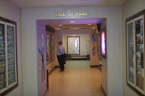
|
| The Road itself, as it appears from the Interstate. This Illinois section, after paralleling the Interstate for many miles as a country road, swings off to the Right (North). | 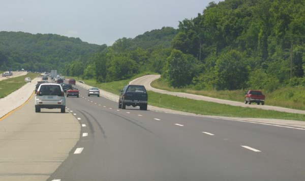
|
| The old Route 66 bridge across the Mississippi, as seen from the Interstate. This bridge has been closed to traffic for many years, though there is some interest in restoring it as part of a bike path. | 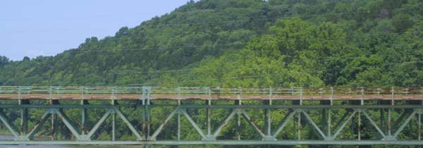
|
| Once more, the old road acts as a frontage road for the Interstate. Note the roadside signs for fireworks, and camping. This stretch of road happens to be going through Missouri. | 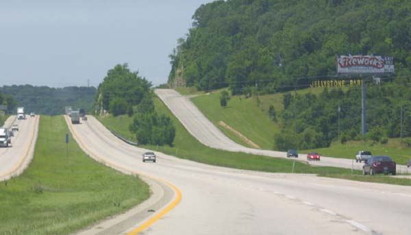
|
| Old 66 angles up through a roadcut, alongside the smooth ribbon of the Interstate. The Interstate is considerably less curvaceous, and less prone to steep grades than was the old road. In part this is due to advances in road building techniques, and in part it was due to the fact that the America which built the Intestates was a considerably wealthier country that that which built the old Federal highways. | 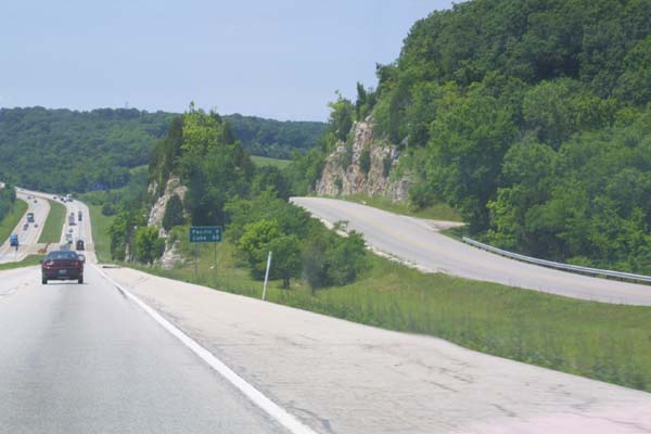
|
| An old stretch of road, formerly part of Route 66, acts as a service and local access road. This photo was taken in western Missouri. | 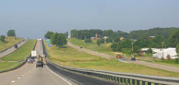
|
| On The Road itself; this stretch is in Missouri. The Main Street of America has become a bit of a backwater in many of the places where the pavement still exists. In this particular area, the Interstate, and thus the main flow of traffic, has swung south to enter Oklahoma. The stretch of road this photograph was taken on, enters Kansas, and then rejoins the Interstate in Oklahoma. | 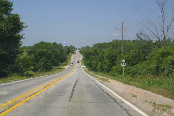
|
| Route 66 In Kansas. At one time, this was one of the busiest roads in the nation, and certainly could lay claim to the title of the busiest long distance road. Today, large sections have been bypassed, and are nearly desolate. | 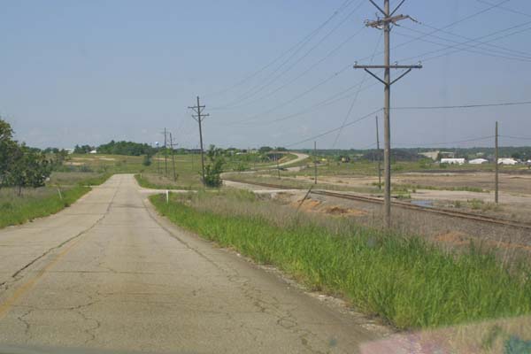
|
| Cities too, have been bypassed, many of them now almost as desolate as the road itself. They have become dim shadows of their former selves, where a few old timers remember the glory days. Fifty years ago, this street would have been a beehive of activity, with the boarded up buildings housing thriving businesses. | 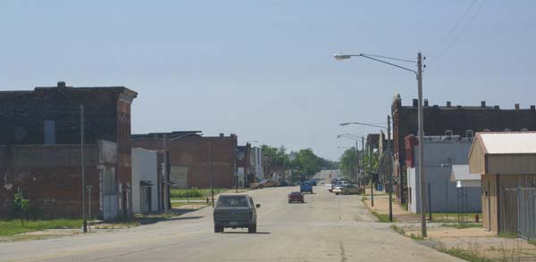
|
| A barbecue shack sits alongside the railroad tracks, on what used to be Kansas 66. The sign promises "Route 66 style B-B-Q". People along the road have a long, fond memory or what the road used to be. | 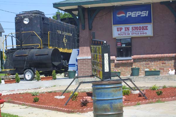
|
| The old railroad station in Galena Kansas. Fortunately, the old structure was saved from the wrecking ball, and has long since been turned into a museum, and a rather nice one at that. | 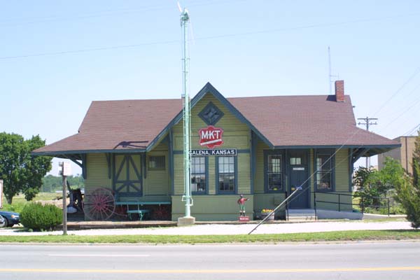
|
| An old bridge in Kansas, once a part of Route 66. It is now a bit off of the beaten path, and fairly desolate, except for the occasional tourist, or local resident. | 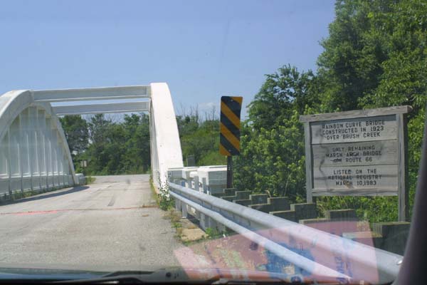
|
| This sign, along side of the scenic arch bridge, shown in the previous photograph, says it all. | 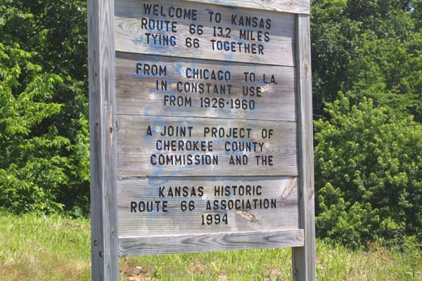
|
| Though Kansas had less of route 66 than any other state, it seems to have taken it's portion of the old road the most seriously. In many ways, the small Kansas section is the best, for those who wish a taste of the old road, because it is the most pristine. The Interstate completely bypassed this section, meaning that the road here is not broken up by ramps, used as a service road, or paved over and integrated with the Interstate. | 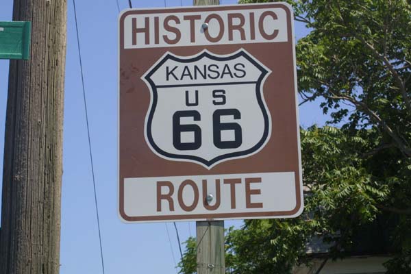
|
| An old, neglected service station bids us farewell as we are nearly out of Kansas, and about to enter Oklahoma. There are many such places along the bypassed sections of the old road. | 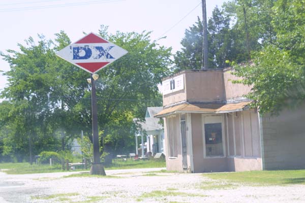
|
| Ollie's acknowledges, and welcomes travelers retracing the path of old Route 66. Long a favorite stop for travelers passing through Tulsa Oklahoma, Ollie's is known for the collection of train sets, and railroad paraphernalia adorning the establishment. | 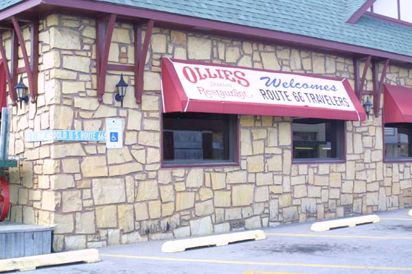
|
| In Oklahoma, old 66 veers off, and then rejoins the interstate in several places. Here, an old bridge, still in use, shows that the road has momentarily come alongside I-40. | 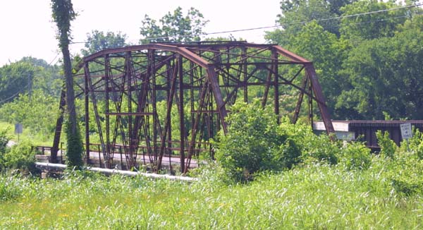
|
| Oklahoma City IS mighty pretty! | 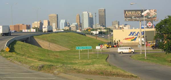
|
| An old Oklahoma farmstead, almost looking like something out of the thirties, adorns the side of the road. | 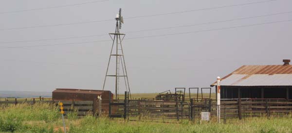
|
| A piece of classic road architecture, in this case an abandoned Conoco gas station. The old road is adorned with many such examples, where they have been allowed to stand. In many cases it is the very desolation of the road they once served, which has saved them. The land they are on is not worth having them torn down for development. This particular structure has had a section taken over by the U Drop Inn Cafe. | 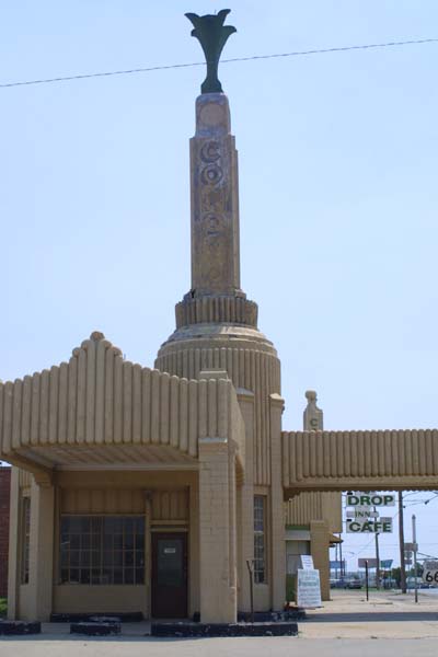
|
| Flying down the Oklahoma turnpike, with the old road traveling alongside. People in these parts call the strip of road here, formerly known as Route 66, the free road. This is less an acknowledgment of the history and adventure of the old road, than it is a commentary on the fact that, unlike the adjacent turnpike, there is no toll to pay. This is part of the longest uninterrupted stretch of the old road, roughly 800 miles. | 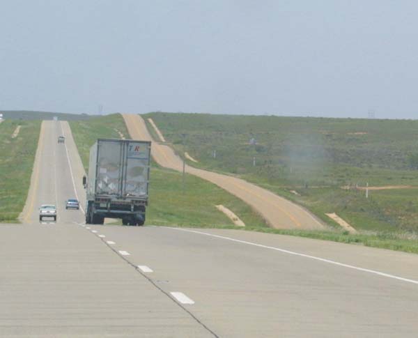
|
| Texas, and the famous leaning tower. This photo is taken from the interstate, but old 66 can be seen in the mid ground as a service road. | 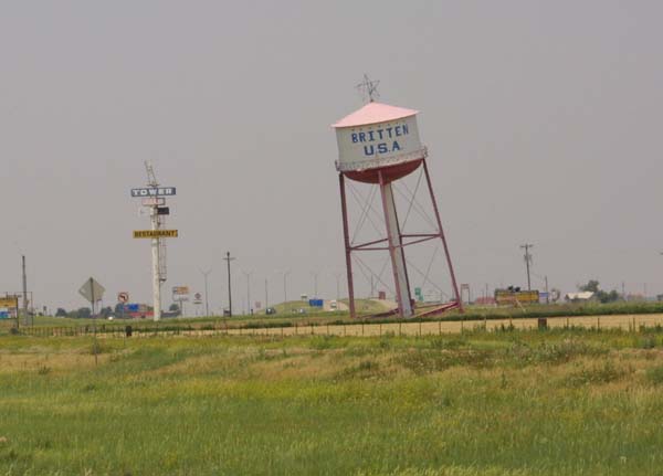
|
| The largest cross in the world, also in Texas. The smaller crosses, almost appearing as if they had come to do obeisance to their larger master, are actually telephone poles. | 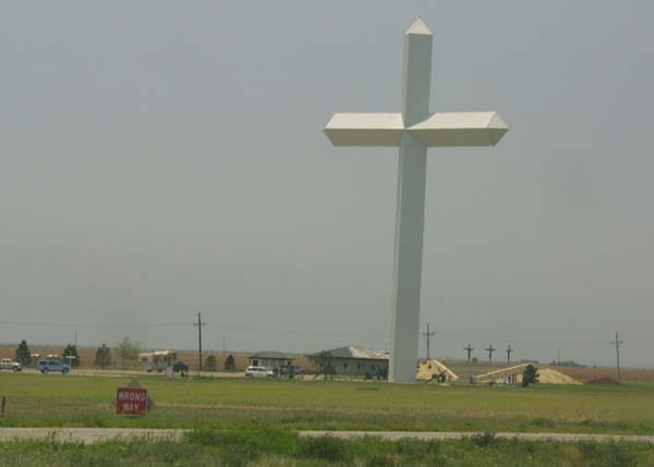
|
| A view down the road in Texas. This is the interstate, but follows the path of old 66 | 
|
| Welcome to Tucumcari, New Mexico, the heart and soul of what old 66 used to be. | 
|
| A look down old 66, at the edge of town, in Tucumcari, NM. | 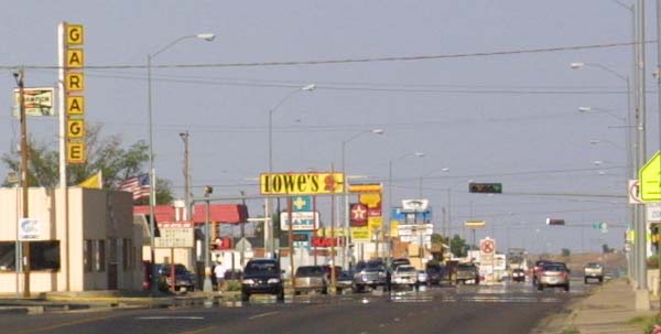
|
| Late afternoon on the desert, just outside of Tucumcari. This desolation stretches for miles around the town, making Tucumcari a very welcome place for weary travelers. This location, out in the middle of nowhere, is what spawned the amazing perfusion of motels, shops, diners, and service stations along the main street of what is otherwise a very small town. | 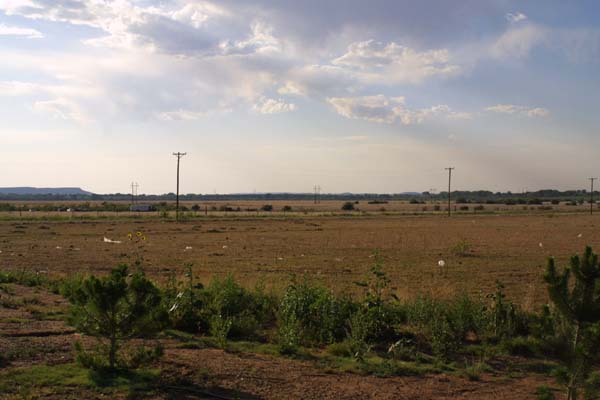
|
|
|
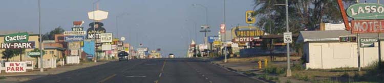
| A shadow of it's former self, the main drag of Tucumcari was once jammed with cars, at all hours of the day. This town had more motels than any other on the road. Today the establishments which remain in business battle with each other for the diminished trickle of tourists and travelers. | 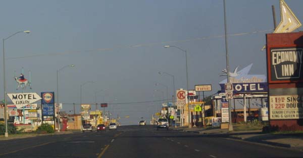
|
| The Blue Swallow is a famous old place, and was a real Mecca back in the hay day of Route 66. It features "100% Refrigerated Air", which is a real draw out here in the desert. It also features an adjacent garage with every room. It was, and continues to be, a class act. | 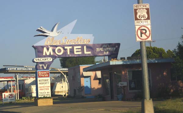
|
| A scene all too familiar on what had formerly been such a lively city on such a vital road. | 
|
| Boasting that it is still "American Owned" the Buckaroo Motel, along with a handful of other traditionally run motels, banks on the new wave of nostalgia, and tourism generated by the road. | 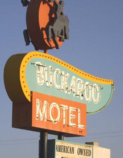
|
| Another old abandoned farmstead, just off the road a bit. This time it is in the middle of New Mexico. | 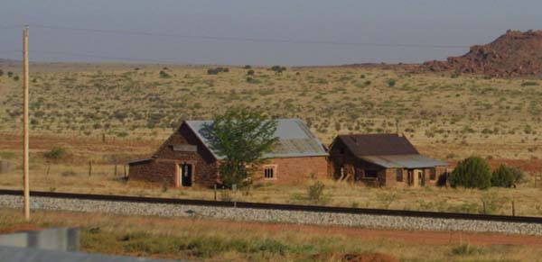
|
| Who says horses are dumb? This one seems to know enough to get out of the sun on a hot day. This is more wisdom than many humans show, while traveling through the desert. | 
|
| The Road goes up a hill and wanders off to the North, while the Interstate continues to roll on straight, seemingly oblivious, and immune to such mundane things as the topology of the land. | 
|
| The Interchange in Albuquerque New Mexico. The Interstate may be a much better and more efficient way to travel, but certainly is bereft of the charm of the old road. This is on Interstate 40. Old 66, wanders off to travel through city streets, and pass through the middle of town. | 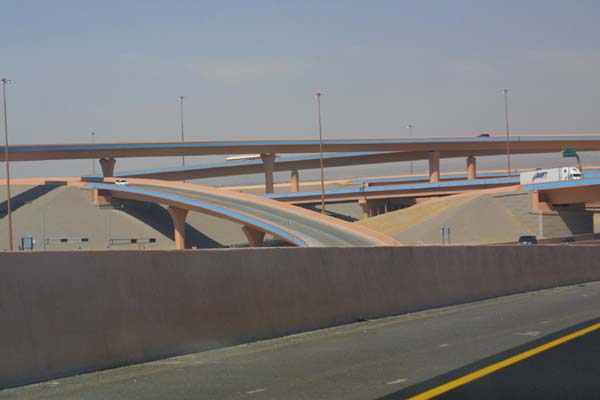
|
| Billboards clutter up the roadside, as they have for decades along old 66. Here the road is visible as a strip of pavement running alongside the Interstate. | 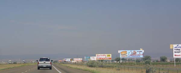
|
| This photograph clearly illustrates what has happened to much of the old road. Off to the right can be seen the twin ribbons of Interstate 40. Directly up the center, is an empty stretch of what had formerly been Route 66. An assortment of ramps, exits, and new construction break the old road up into a series of smaller strips of pavement. This photo is taken from the bridge shown in the following frames. | 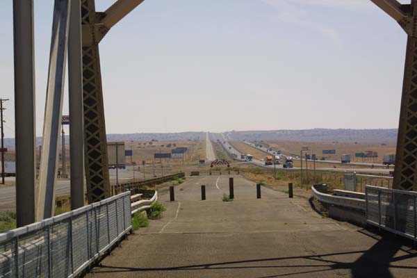
|
| The Pig River, pretty dry at the time of year this was taken. This old crossing by Route 66, has been circumvented, even by the secondary road. The old truss bridge, which spanned the river for generations, has been replaced by a newer and duller structure built alongside. | 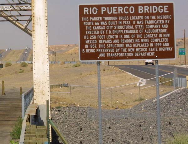
|
| The old bridge, alongside the new. The old bridge was deemed ready for replacement in 1999, but instead of being torn down, it was bypassed, and preserved, with the newer bridge built alongside. Like many of the relics of the old road, it's replacement is far less romantic, if somewhat more efficient. | 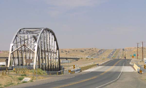
|
| The old and new roads both run within the boundaries of Indian reservations. The reservations sport a number of roadside stands, where tourists look over an assortment of crafts and curios. | 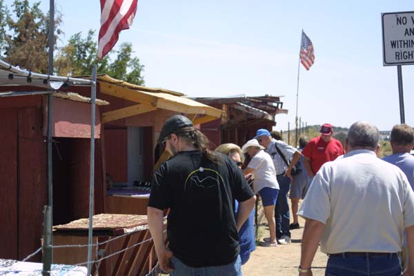
|
| Typical New Mexico landscape. A train runs in the midground, set amidst the hills of the painted desert. In the foreground can be seen the old road, now a local access road, which had formerly been part of Route 66. | 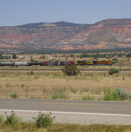
|
| An old, worn tractor stands a lonely vigil, just off the road in New Mexico. It has obviously been quite a while since this tractor was used, or since the land here was tilled. | 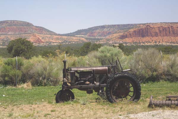
|
| We are a mile and a half high, and at the Continental Divide. In theory, a cup of water spilled on one side of the divide would end up flowing to the Atlantic, while one spilled on the other side would be taken to the Pacific. In practice, I don't see too much water in these parts, and suspect that evaporation plays a larger part in the process here, than flow. | 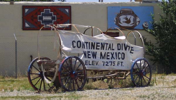
|
| One of a trio of tourist stops located on the divide. These places are quite fascinating, and it is difficult not to spend money in them. This one calls itself an Indian village (read store). | 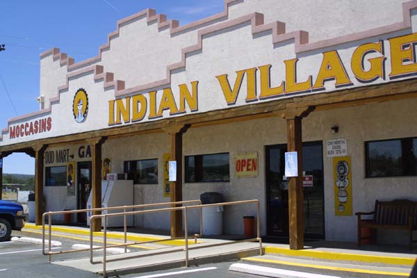
|
| Just like the stereotypes of the forties and fifties, you can by blankets, rugs, and pottery, along with a selection of handicrafts, and other goods. This Indian market is right on the Continental Divide in New Mexico, where the road passes through an Indian reservation. | 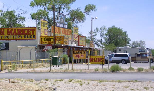
|
| Another shop on The Continental Divide, this one seeming a bit forlorn. Note the solar collectors on the roof, a very practical addition out here in the desert. | 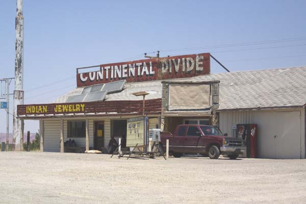
|
| A teepee, and an offer of a free arrowhead tell me that I am nearing the Arizona border. | 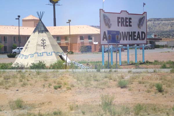
|
| More signs announce the wonders awaiting me after I cross into Arizona. | 
|
| Near the border, the old road can be seen, adorned with billboards. | 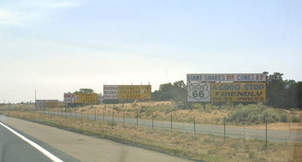
|
| Petrified Forest National Park, along with the adjacent Painted Desert Monument, are two great spots on old 66, which should not be missed. The painted Desert is very reminiscent of my beloved Badlands, and the Petrified Forest, is like nothing I have ever seen. | 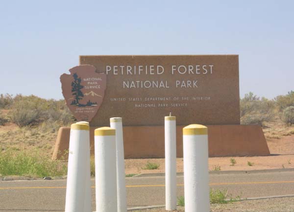
|
| A vintage Chevy, an original Volkswagen bug, a slew of motorcycles, and that workhorse of the southwest, the pick up truck, seem quite natural out in front of the old Teepee motel rooms. A more conventional structure stands in the background. | 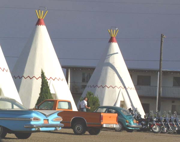
|
| Well hop in the old family wagon and head off for a night in a teepee. If it were only that easy. Many of these places are booked, during the tourist season, as a new generation of Americans, and foreign visitors discover the historic old road, and long for an "authentic" experience. | 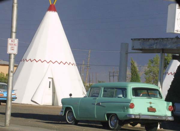
|
| This must be the place. This is the sign indicating that we have arrived at Jackrabbit Arizona. I have seen this sign in every guidebook, picture book, and travelogue about Route 66. This little place has become one of the favorite landmarks and stops along the old road. | 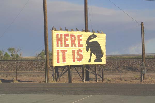
|
| The town mascot of Jackrabbit. Also a pretty good place to get a picture of the kids (or yourself). | 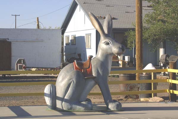
|
| The rest stop at Jackrabbit. This is a sort of a miniature version of Wall Drug, carrying a bit of everything, out in the middle of nowhere. This place has the best cherry cider I have ever tasted. | 
|
|
|
|
|
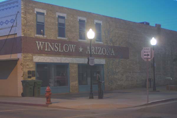
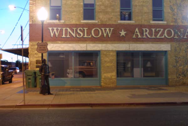
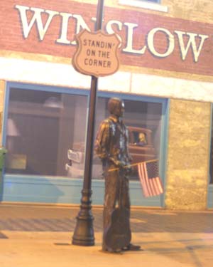
This was the spot which inspired the line from one of the great road songs of the seventies. The city built a little park here with a statue, and a mural. The paving stones all have messages inscribed upon them. Every year there is a celebration of sorts with bands, food, and other activities. The park has it's own web site, and you can be immortalized by having your own message etched into one of the paving stones. |
|
|
Winslow was, for a long time, the largest city in this part of Arizona. Flagstaff has since overtaken it. The California presence is noticeable here, though it is not overpowering as it is in Sonoma. The difference between a place like Winslow, and Losangeles is astonishing. Californians visit here to view the contrast, escape the city, and then go back home. |
|
| Meteor City (population 2) is just the sort of place you would expect to find out in the middle of the desert. Among other things, it boasts the largest existing map of Route 66. | 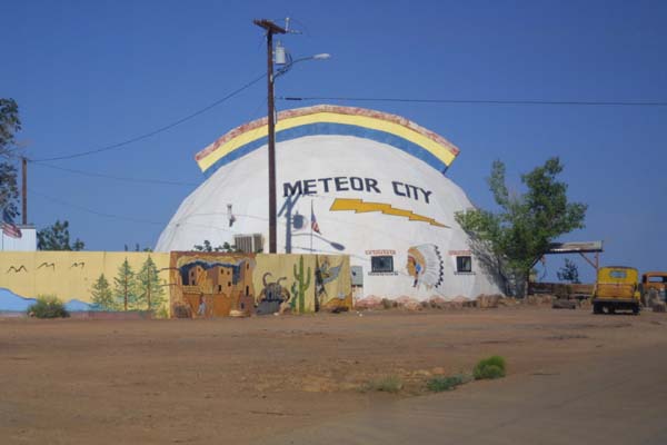
|
| Here is the big hole in the ground made by a large meteor which struck here, with great force, thousands of years ago. Meteor Crater is a private enterprise, rather than a part of the National Park Service. | 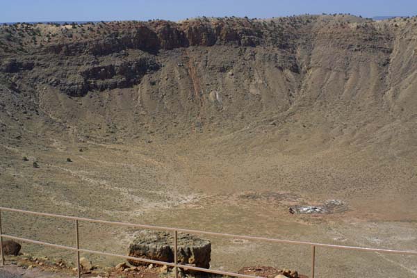
|
| Not much of a market for mountain lions, it seems. Though all of these places are visible from the Interstate, they are not really accessible from it. The old road passed right by them, or even right through them, but the Interstate is strictly limited access. This particular garden spot is called Two Guns.It is located directly across the road from the equally old, and historic Canyon Diablo. | 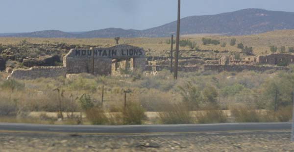
|
| Apparently, everything comes in twos out here on the traveled portion of the Arizona desert. The name of this place, in case you can not figure it out, is Twin Arrows. | 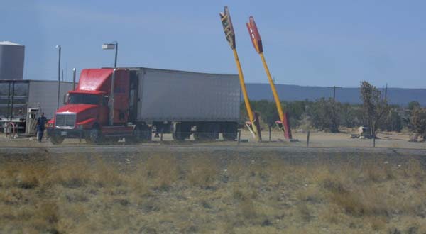
|
| The Road, as it appears while twisting through Flagstaff Arizona. What used to be called Route 66 is here called Business 40, as it winds through the the liveliest part of Flagstaff, and through the middle of town. The outskirts, on both ends of town are filled with motels, eateries, night spots, and souvenir shops. This section is probably as close as you can get to the feel of what the road was like back in it's prime. | 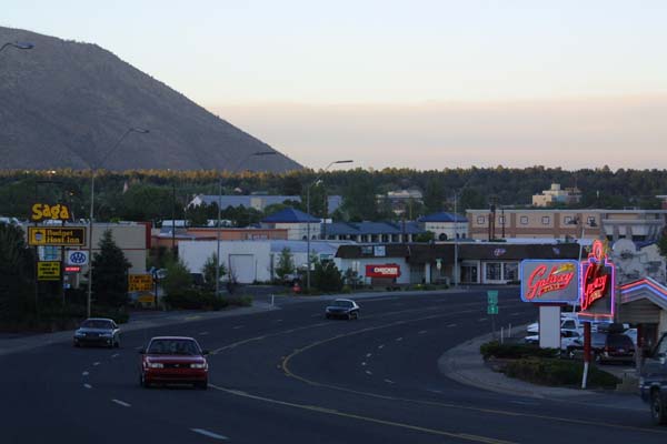
|
Go, travel. See the old road and introduce yourself
to the varied nation it has been intimate with for decades.